
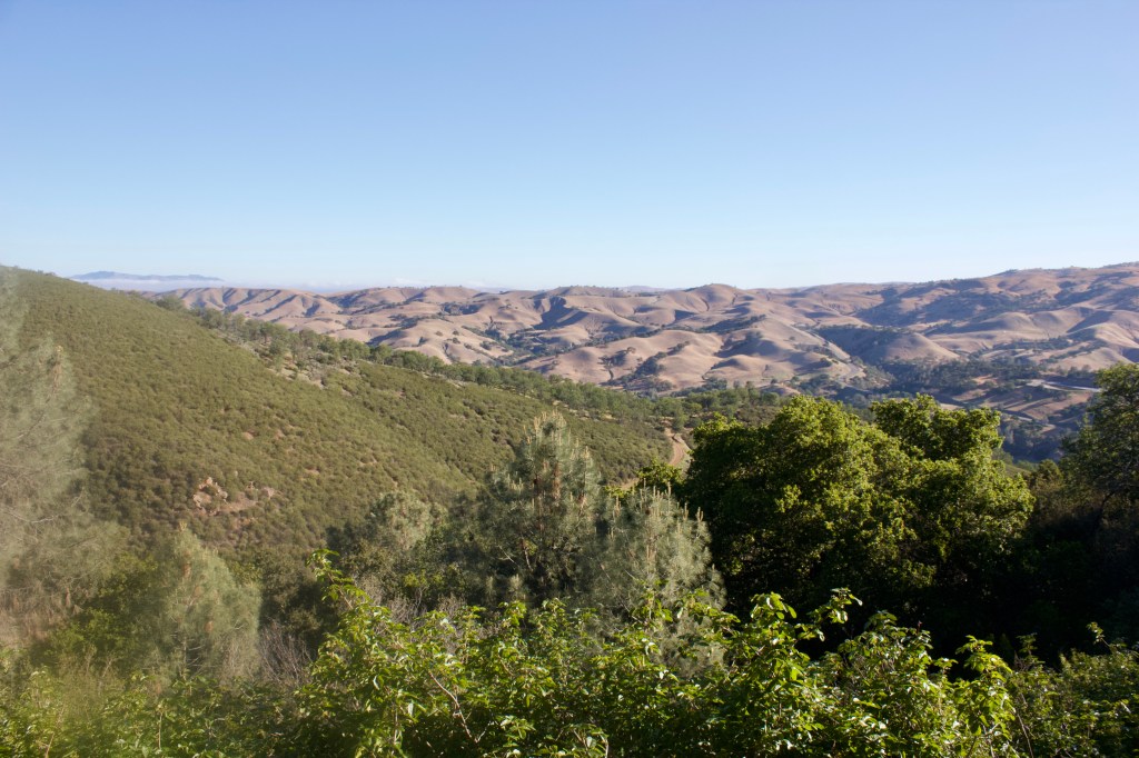
Tucked deep into the oak-coated hills east of San Francisco Bay is Rose Peak — Alameda County’s highest accessible point. Sitting at 3,817 feet, this peak — which is more or less a bump along the Ohlone Wilderness Trail — offers spectacular views and is an appropriate destination to test your hiking abilities.
Considered one of the most challenging hikes in the Bay Area, Rose Peak is accessed by one of two ways; a grueling up-and-down fest starting at Lake Del Valle or a more gradual approach from the Sunol Visitor Center. Either way, you’re looking at about 20 miles with over 5,000 feet of elevation gain to check this one off your list. This report covers the approach from Del Valle.
Details
- Total distance: 19 miles, out & back
- Elevation gain: ~5,000 feet
- Time: Full day/Overnight
- Difficulty: Hard
- Highlights:
- Views
- Wildflowers
- Wildlife
- Waterfall
- Parking: West Beach parking lot at Lake Del Valle
- Dogs allowed: Yes
- Permit required: Yes
- Notes
- Water sources can be unreliable and need to be filtered. We went through almost 12 liters between two people on a mild day.
- This hike can be an absolute scorcher in the summer months.
- Abundance of poison oak along “Big Burn” stretch.
- There are several camps along the trail, but must be reserved in advance.

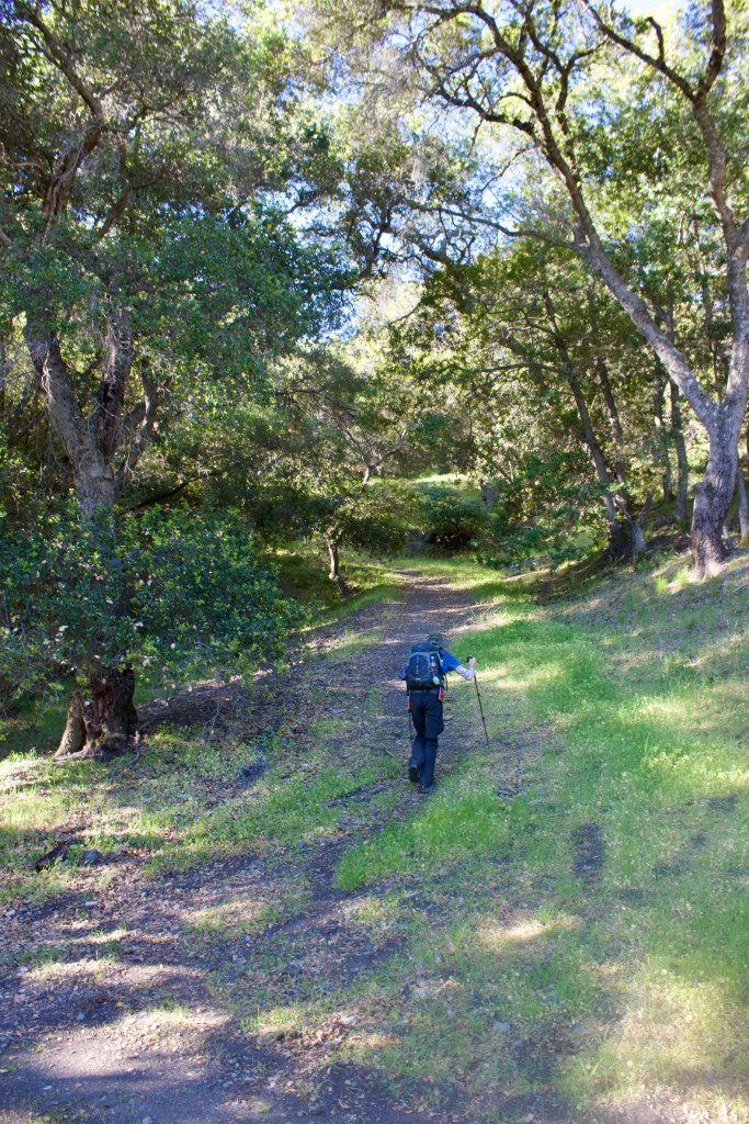
Upon leaving the trailhead, you start climbing immediately. The trail flattens out about three quarters of a mile in, right before you reach the sign-in panel — permits are required past this point.

After leaving the sign-in panel, the trail wraps around and climbs straight for nearly three quarters of a mile. Although this section is pretty steep, excellent views make it more enjoyable.
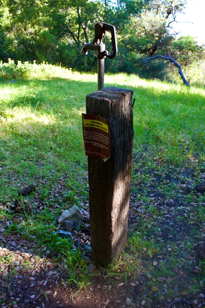
At marker 39, you will hit the Stromer Spring Junction. Make a right to get to the spring.

The area around the spring is typically very muddy, but was bone dry as of late April 2021. We were not able to pump any water out of the faucet. There was some liquid in the green tank next to the spring, but a warning label made us a bit hesitant.
From here, you can take the connector trail up to Boyd Camp. This will bypass a pretty steep section of the main trail. There are a number of bedrock mortars in a cluster of rocks here as well. The natives used these cavities to process acorns — a staple of their diet. For me, it is always fascinating to stand exactly where this activity took place hundreds of years ago.

Continue up the connector for roughly 10 minutes until you meet back up with the trail. Here, you will run into Boyd Camp. Campsite one is a nice little camp off the main trail with some great views.

After leaving Boyd Camp, the trail intersects the Rocky Ridge Trail at grassy knoll to your right. A quick detour onto Rocky Ridge provides a spectacular view and wildflower opportunities. The Rocky Ridge Trail loops back to Stromer Spring if you would like to catch the evening light on your way down.
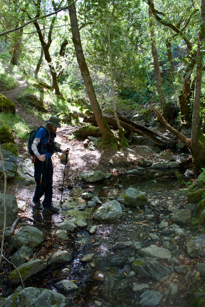
From the Rocky Ridge Junction, the trail descends gradually and you want to make a right at marker 37 to head down to Williams Gulch. The creek is generally pretty reliable — it had decent flow in late April 2021. In June 2016, I heard it rushing from the top of Rocky Ridge.
From Williams Gulch, you head up “Big Burn” — a series of switchbacks that do not necessarily “burn,” rather give you a break from the steep fire roads. With encroaching brush and downed trees, this stretch gave me a true wilderness-like feel.

After about a mile, you will reach Schlieper Rock. Located at the top of Big Burn, this massive outcropping provides one of the best views in the interior East Bay. An unobstructed view of Mount Diablo from such a high vantage point gives you a true sense of its height. And on a clear day, you can see the snow-capped Sierra across the Central Valley.

About three quarters of a mile after leaving Schlieper, you arrive at Johnny’s pond. From marker 35 you can either head left towards Rose Peak or right to head down to Murietta Falls, a 100-foot fall that is rather uninspiring unless caught after heavy rains. You can meet back up with the Ohlone Trail via Greenside Road if you choose to include this.
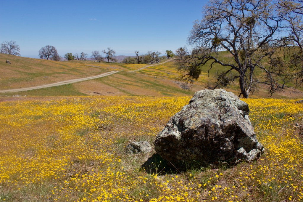
After reaching Shafer Flat, the gentle hills became littered with goldfields. This was an absolute treat, one rivaled only by the poppies atop Rose Peak.
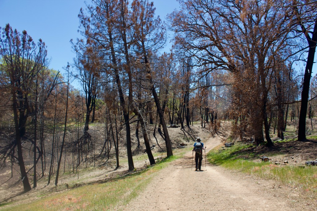
After the goldfields, between markers 32 and 33, we traveled through the stretch hit hardest by the wildfire. Many of the pines were parched and a few black oaks perished, but the damage was not as great as we thought it would be.
A little over a mile later at marker 31, you will make a left and descend into the North Fork of Indian Creek. Rose Peak is visible across the canyon. After crossing the creek, there is one final steep section. After marker 30, you are pretty much in the clear. The junction for Maggie’s Half Acre Camp is at marker 29.


The poppies on the south-facing slope were incredible.

Overall, this was a great hike and the views are definitely worth the trek. This one had been on my list for years, and I am stoked to have finally checked the box. I hope this report helps and thank you so much for reading!
