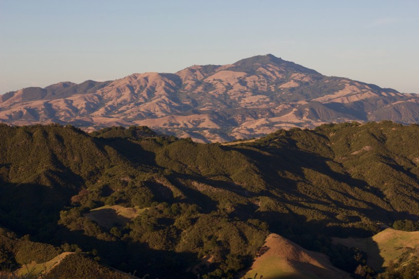
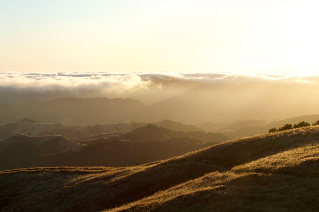
Skirting the western edge of Las Trampas Regional Wilderness, Rocky Ridge is a narrow spine that offers some of the finest ridge walking in the East Bay. With panoramic views of the bay, massive rock formations, and an abundance of wildflowers in spring, this 2000-foot ridge is a prime location for an evening hike.
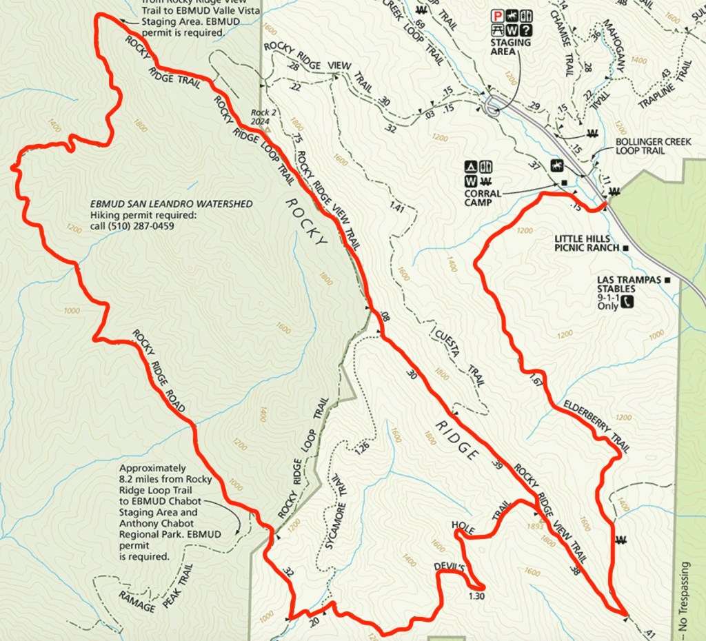
This lollipop loop — starting at the Elderberry Trailhead — includes Rocky Ridge as well as a remote portion of the San Leandro Watershed on East Bay Municipal Utility District (EBMUD) land. A permit is required for the latter section, but there are other routes — solely within the regional park — that include the ridge.
Details
- Total Distance: 10 miles, lollipop loop
- Time: 4-5 hours
- Difficulty: Moderate
- Highlights:
- Views
- Wildflowers
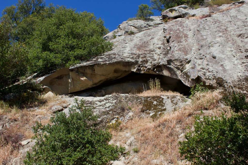
- Cave
- Rock formations
- Parking: Elderberry Trailhead (Just outside of park’s main gate)
- Dogs: Yes, but not allowed on the EBMUD portion
- Permit: Yes, but only for EBMUD portion
- Notes:
- Bring plenty of water, some sections are steep and exposed
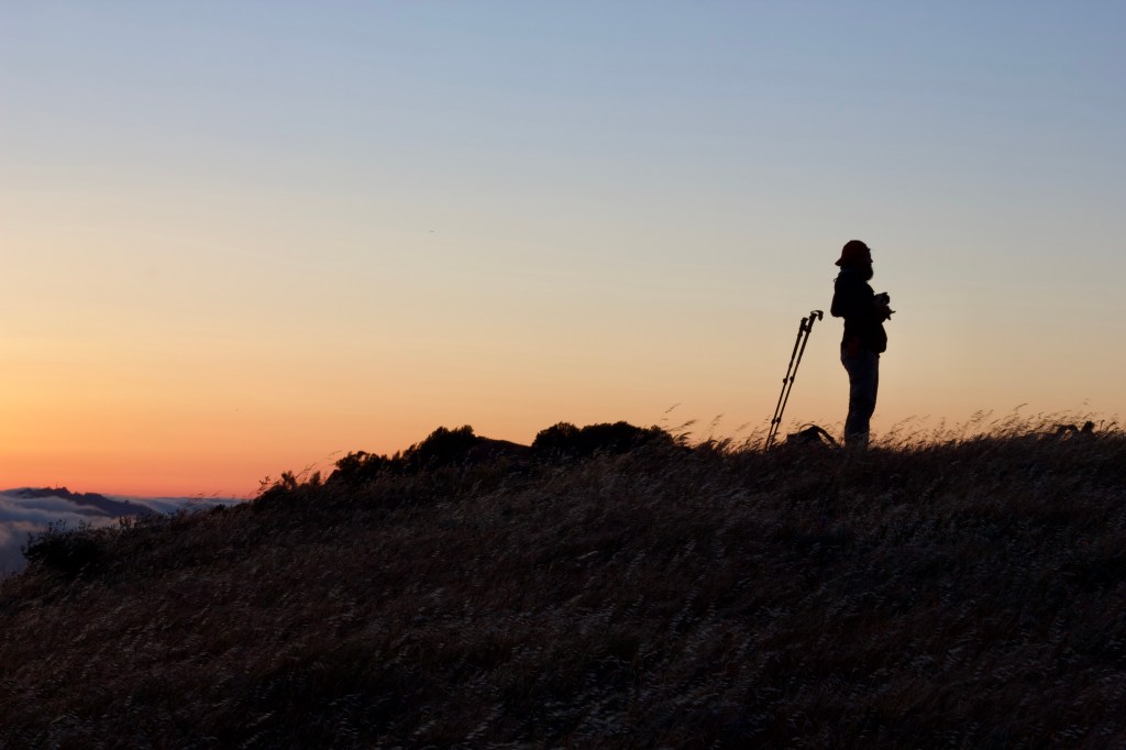
- Bring a headlamp if you intend to catch the sunset
- Bring a jacket, it can get windy up on the ridge
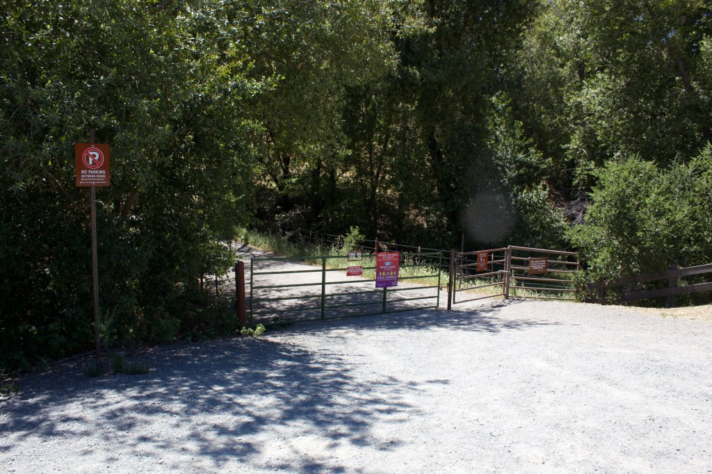
The trailhead and parking area is located on your left, right before you enter the park’s main gate.
The Elderberry Trail is a wide fire road that travels through oak and bay woodland with a great view down Bollinger Canyon. This stretch is shaded fairly well, but there are a couple steep, exposed sections at the beginning and very end.
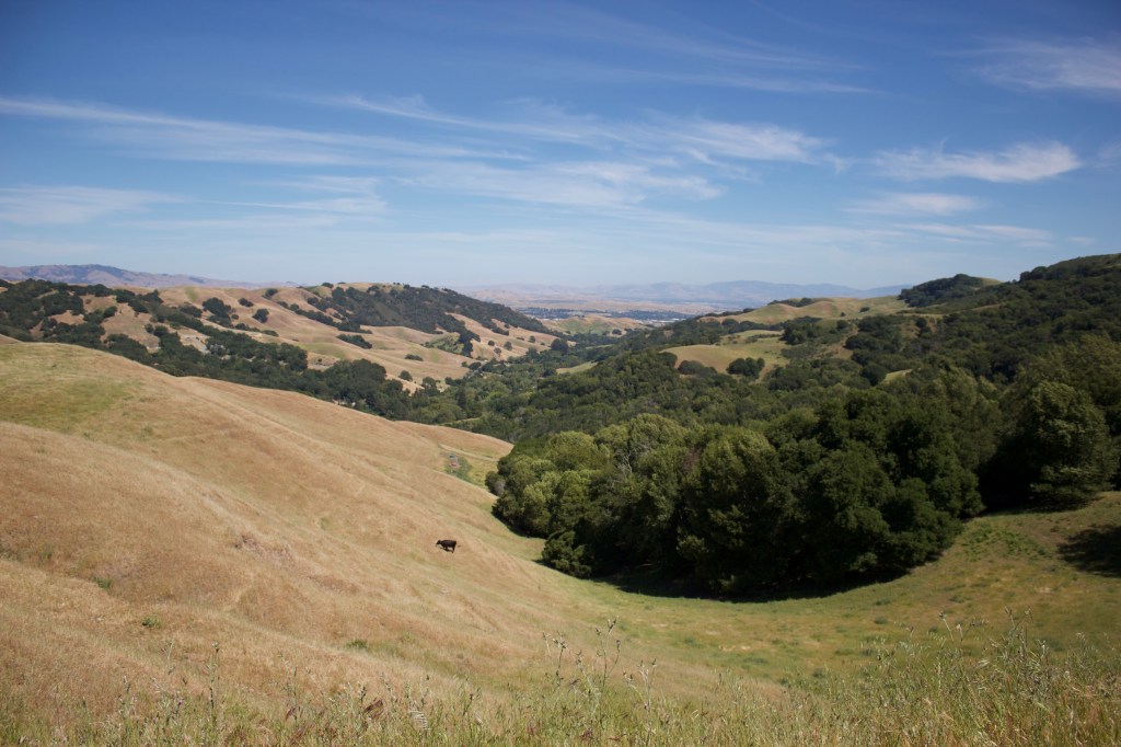
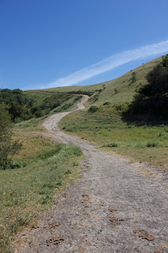
As you reach the top of the Elderberry Trail, spectacular views of the bay open up.
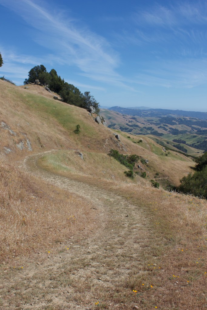
From here, make a right onto the Rocky Ridge View Trail. After a couple steep hills, make a left onto the Devil’s Hole Trail. This stretch is fairly steep and exposed but gives you a great sense of solitude.
Along this section, there are massive greywacke outcrops — a type of sandstone that has a granite-like look to it because it contains fragments of volcanic rock.
As you reach the bottom of Devil’s Hole — right before a large eucalyptus — you can turn right to head up the Sycamore Trail to avoid the EBMUD portion. I got a permit because it opens up several hiking opportunities, but may or may not have hiked some of their trails without one.
If you choose to keep going, continue straight for about a fifth of a mile and make a right onto a fire road. At the top, you will run into a gate at the EBMUD boundary.
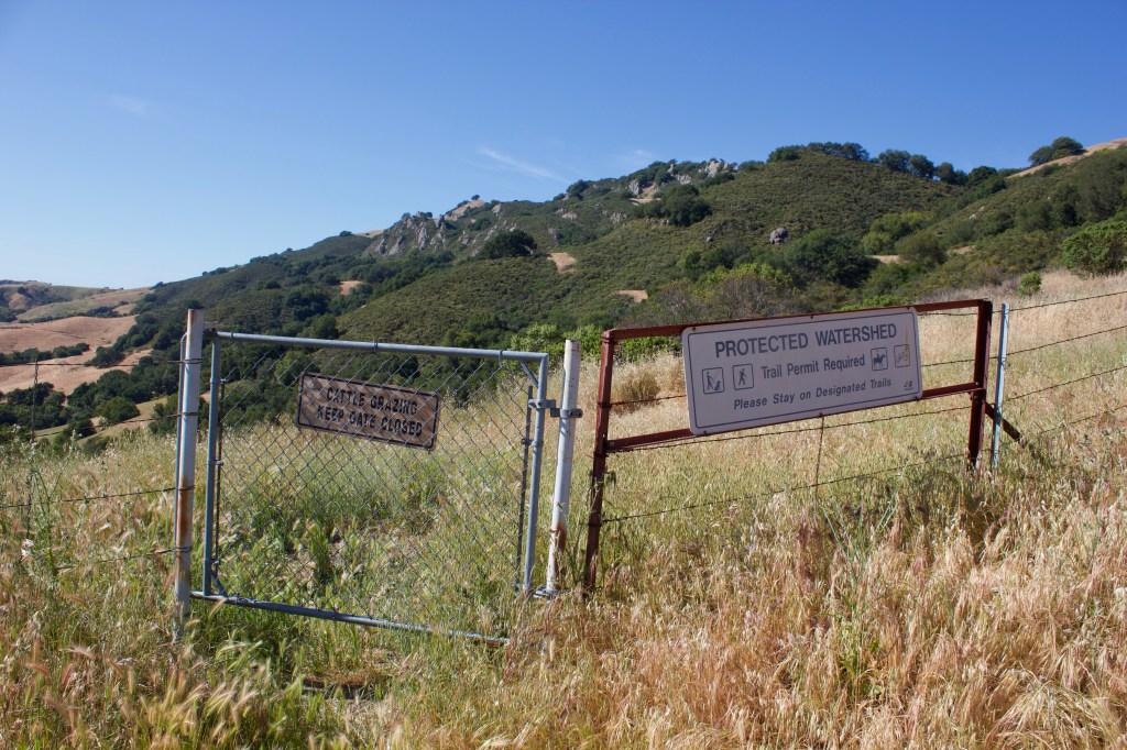
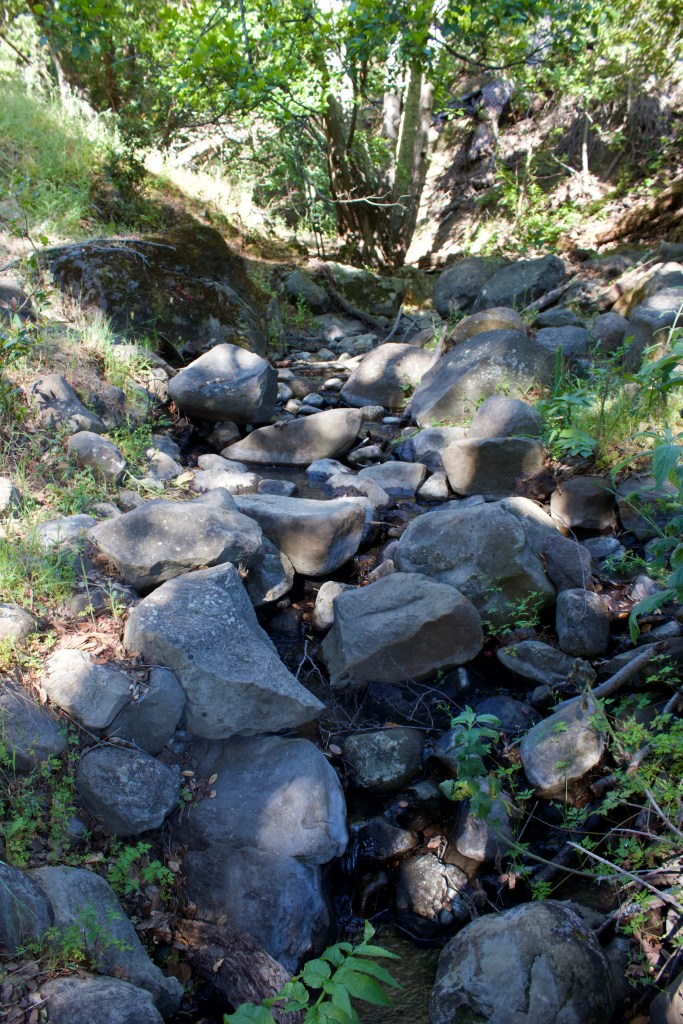
Once through the gate, make a left and walk about 200 yards until you see another gate just off the road to your left. Go through and make a right. About half a mile in, you will come to another gate — just past it there is a small creek that had decent flow in mid-May 2021. I was shocked to find water down here in a very dry year.
After, the road becomes quite exposed but you get a great view of the backside of Rocky Ridge. It is fairly overgrown in some parts, and at one point, a baby rattlesnake slipped into a crevice just a foot or two in front of me — a nice little wake-up call!
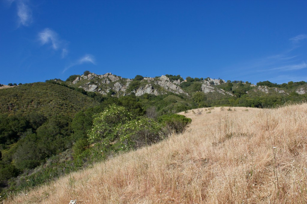
Once you get to a junction, make a right back onto the Rocky Ridge View Trail. This portion is fairly steep and exposed, but has excellent views to the north.
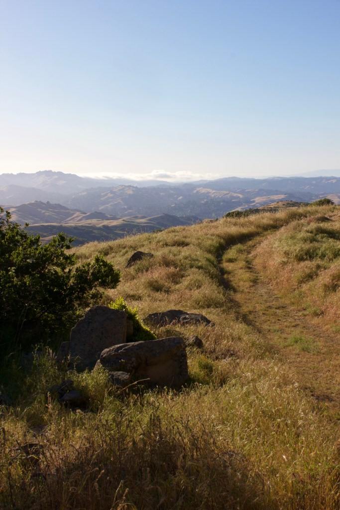
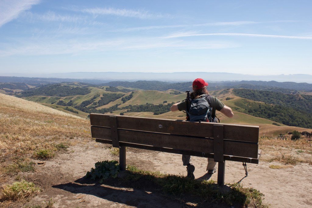
Once you are close to the top, you walk through a beautiful stand of bay. Continue past the radio tower and enjoy the sunset!
Head back down Elderberry or one of the other trails. Thank you for reading!
